Snowdon, highest mountain in England and Wales at 1085 metres (3560 feet). These pictures taken during a walk in May 2009.
![]()
![]()
![]()
![]()
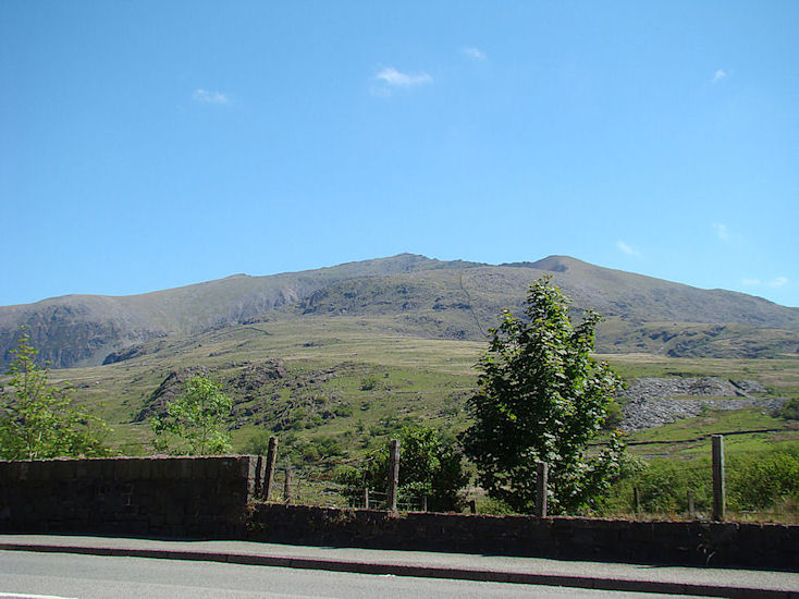 |
| Snowdon from the pub at Rhyd Ddu. The summit is at dead centre. The Rhyd Ddu path moves up onto the Llechog ridge in the foreground, then around to the right to move along the craggy south ridge to the summit. |
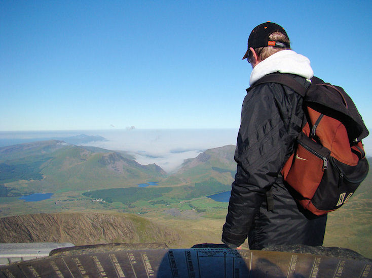 |
| View from the summit looking southwest along the ascent route. Rhyd Ddu is the small cluster of white buildings left and below centre, just above the precipitous face of the Llechog ridge. The camera is sitting on the summit pedestal. The sea and coastal valleys are misted, and despite the clear sunny weather it is still quite cold at 8 am in the morning, hence all the clothing. |
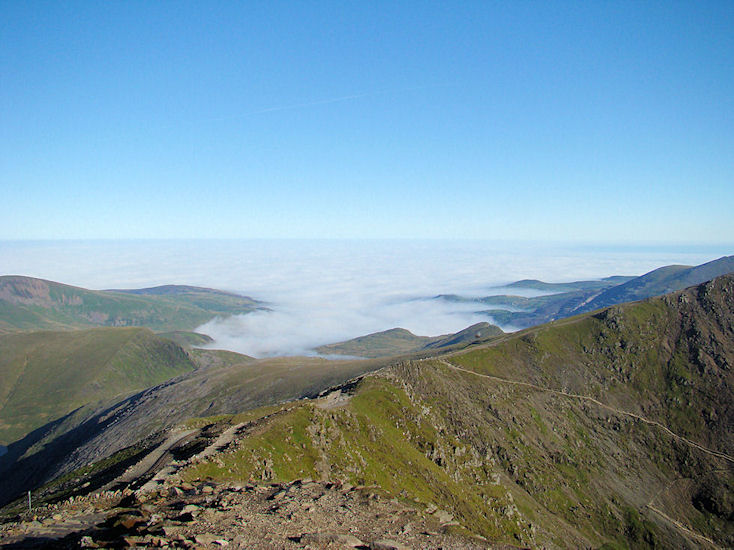 |
| View from the summit looking north. The Snowdon Mountain Railway can be seen going down on the left. The ascent path from Pen-y-Pass can be seen coming up from the right (the Pyg and Miners Tracks combine for that section). My descent was down the Snowdon Ranger path which follows the curved slope moving off to the left. At this time the sea and coastal valleys were still misted up. |
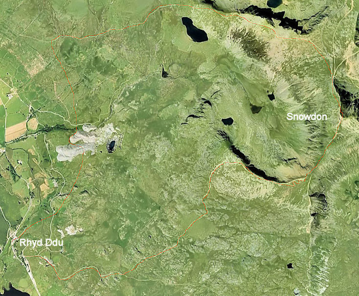 |
| The route taken is shown in red. Starting at the carpark at Rhyd Ddu station, up to the Llechog ridge then east to gain the south ridge and the summit. Then north and west along the Ranger, turning left to go southward along a path through old slate quarries to re-join the road at Rhyd Ddu. |
Total time for this route was 7 hours. Distance about 7 or 8 miles, height gain about 800 metres. Fairly easy going although the
south ridge was a little exposed with a brisk easterly breeze blowing. Clear skies and low level mist made for magnificent views.
A map of the route is shown here